Looking for oversized, easy-to-read United States maps that make classroom lessons or wall displays pop? This guide highlights top large-print US maps, focusing on size, durability, lamination, and ease of use. Each option is designed for bold visibility, whether you’re teaching geography, planning travel routes, or simply decorating a spacious wall. Read on to compare the strongest contenders and find the best fit for your space.
| Product | Brand | Size / Format | Lamination / Durability |
|---|---|---|---|
| Maps International Giant Classic USA Mega-Map | Maps International | 46 x 80 inches | Front laminated; write-on surface |
| 24×36 United States Classic Elite Wall Map | Swiftmaps | 24 x 36 inches | Laminate; rolled or folded options |
| 48×78 Huge United States Classic Elite | Swiftmaps | 48 x 78 inches | Front-sheet UV coating; durable lamination |
| 24×36 United States Classic Elite (Folded) | Swiftmaps | 24 x 36 inches | Folded; durable, coated poster paper |
| 24×36 United States Executive Wall Map | Swiftmaps | 24 x 36 inches | Two-sided laminated; dry/wet erase |
| 48×70 United States Executive Wall Map | Swiftmaps | 48 x 70 inches | Rolled; laminated both sides |
| 32×50 United States Premier Blue Oceans | Swiftmaps | 32 x 50 inches | Laminated; two-sided |
Maps International Giant USA Mega-Map, 46 x 80 Inches

The Maps International Giant Classic USA Mega-Map is the largest single-sheet USA map available, measuring an impressive 46 by 80 inches. Created by expert cartographers, this colorful wall map works well in classrooms, large family rooms, and office spaces. The front sheet is laminated for durable, write-on usability, making it suitable for teaching, planning, and interactive activities. This map emphasizes up-to-date geographic details and a bold, easy-to-read presentation that supports quick reference and engagement.
24×36 United States Classic Elite Wall Map (Laminated)

This 24 x 36 inch United States Classic Elite wall map offers a practical balance of size and clarity. Printed on 24-pound poster paper and finished with a laminate layer, it stands up well in busy environments like classrooms or office walls. It’s a versatile choice for home use too, providing a clear overview of U.S. states, major cities, and routes without overwhelming detail. A matte or glossy finish is not specified, but lamination helps with wipe-clean usage during lessons and activities.
48×78 Huge United States Elite Wall Map

For spaces needing an expansive, highly legible map, the 48 x 78 inch Elite Wall Map from Swiftmaps delivers. It features front-sheet UV-coated lamination for dry-erase durability, preserving color and clarity with repeated erasing. This option is ideal for large classrooms, conference rooms, or public spaces where quick spot-checks and interactive lessons are common.
24×36 United States Elite Wall Map (Folded)
Designed for portability and versatility, this 24 x 36 inch folded United States wall map offers strong readability with functional use in smaller spaces. The folded format makes shipping and storage easier, while the coated poster paper provides durability for frequent handling in classrooms and homes alike. It’s well-suited for teaching aids, student projects, and quick reference guides.
24×36 United States Executive Wall Map (Laminated)
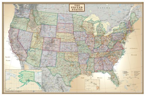
The Executive Wall Map provides a compact, practical 24 x 36 inch option with durable, two-sided lamination suitable for dry-erase and wet-erase use. This map emphasizes legibility and a professional look, making it a strong choice for corporate settings, classrooms, or study areas that require frequent updates and annotations without wear on the map surface.
United States Executive Wall Map (48×70, Laminated)
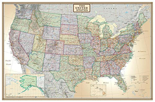
The XXL 48 x 70 inch Executive Wall Map offers an oversized display for broad visibility and teaching impact. Rolled packaging ensures safe transport, while durable three-mil laminated surfaces enable long-term use in classrooms, training rooms, and large homes. The map prioritizes legibility and geographic detail, supporting wide viewing from a distance.
Swiftmaps Premier Blue Oceans 32×50 Map
This 32 x 50 inch Premier Blue Oceans map features a modern, up-to-date political layout with a distinct blue ocean design. Printed on 24-pound poster stock and laminated on both sides, it combines durability with ease of cleaning and long-term readability. It’s a suitable mid-sized option for classrooms, offices, or study spaces that want a visually appealing, contemporary map style.
Buying Guide: Key Purchase Considerations
- Size and visibility: Choose a map that fits your wall space and seating arrangement. Larger formats like 46 x 80 inches provide maximum legibility from a distance, while 24 x 36 inches work well for smaller rooms.
- Durability: Lamination protects against spills and smudges. Front-sheet lamination allows dry-erase use, while two-sided lamination offers more versatility for frequent erasing.
- Format and packaging: Rolled maps save space and reduce the risk of creases, while folded maps are portable but may be less durable over time.
- Surface feel and readability: Glossy laminates can enhance color vibrancy but may cause glare; matte options reduce glare and are easier to read under bright lighting.
- Educational features: Look for up-to-date political boundaries, clear state lines, major cities, and easy-to-read legends to support learning objectives.
- Maintenance: Wipeable surfaces simplify classroom hygiene and quick cleanups after activities, while some maps may require dry-erase markers designed for the surface.
- Cost vs. value: Consider whether the map’s size, durability, and features justify the price for your setting—classroom, home, or office.
- Installation needs: Ensure you have appropriate wall space and mounting hardware if you plan to hang a large map, especially oversized formats.
- Usage scenario: For teaching, prefer maps with bright colors and legible fonts; for planning, dry-erase surfaces support annotations and updates over time.