Exploring maps up close can transform a room into an interactive learning space. This article highlights five highly detailed world maps from trusted brands, each offering different formats—from laminated wall maps to scratch-off travel posters. Use these selections to compare detail, durability, and display style so you can choose the best fit for classrooms, offices, or home study areas.
Summary Table of Featured Maps
| Product | Brand | Format | Key Feature | Image |
|---|---|---|---|---|
| Rand McNally Classic Edition World Wall Map – Laminated Rolled | Rand McNally | Laminated Wall Map | Up-to-date, relief shading, Africa-centered |  |
| World Classic Wall Map Poster Mural (24×36) | Swiftmaps | Poster (24×36), folded | Large size, easy transport via folding |  |
| Laminated World Map & US Map Poster Set – 18×29 | Palace Learning | Laminate Poster Set | Durable lamination, US and world maps |  |
| Scratch The World Travel Map – Frameable XL | Maps International | Scratch-off Travel Map | Interactive design, 23×33, updated 2025 | 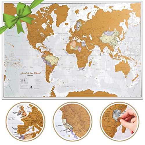 |
| Maps International Giant World Map – 46×80, Laminated | Maps International | Giant Laminated Map | Extremely large, 1:20m scale |  |
The following sections provide deeper details for each option, so you can assess which map best suits your space and audience without guessing about durability, readability, or display style.
Rand McNally Classic Edition World Wall Map
The Rand McNally Classic Edition World Wall Map is a laminated, rolled map designed for frequent handling in classrooms and offices. It features completely up-to-date country boundaries, and relief shading to emphasize terrain. The map is Africa-centered, ensuring viewers can see most African countries in full detail and positioning, which can aid in quick geography orientation. Laminated surface enhances durability and makes it easier to wipe clean after use. This option suits environments requiring a durable, always-ready wall reference with sharp color contrast for quick recognition of physical features and political boundaries.
World Classic Wall Map Poster Mural (Swiftmaps)
The Swiftmaps World Classic Wall Map Poster offers a large 24″ x 36″ display, printed on sturdy 80 lb poster paper and designed for easy folding to travel or storage. While not a laminated sheet, its large format makes details accessible from a distance, which is ideal for classrooms and shared study spaces where wall space is at a premium. The folded design eliminates the need for rolling storage, making setup quick and convenient for temporary displays or events. It provides a visually engaging overview of political boundaries and major geographic features.
Laminated World Map & US Map Poster Set – Palace Learning
This laminated poster set includes a world map and a United States map in a compact 18″ x 29″ format. The 3-mil lamination adds durability while preserving color and detail. The combination makes it a versatile choice for classrooms or home study areas that need both global and national geography references in a single, compact package. The laminated surface supports frequent writing and erasing with appropriate markers, facilitating interactive geography lessons or planning exercises.
Scratch The World Travel Map – Frameable XL
The Scratch The World Travel Map by Maps International combines an abstract political base with a scratch-off layer to reveal the colorful map beneath. This XL edition measures 23″ x 33″ and is framed for display. The scratch-off feature invites interaction, making it an engaging option for travel enthusiasts and education spaces focused on exploration. The map includes country borders and key geographic detail, with a design that blends poster aesthetics with a learning tool. It is updated through 2025 to reflect current political boundaries.
Maps International Giant World Map – 46×80 Laminated
The Maps International Giant World Map stands out as an oversized, laminated reference with a 46 x 80 inch footprint. Its 1:20m scale makes it an excellent centerpiece for classrooms, libraries, or large learning spaces where students can crowd around to study country locations and borders in detail. The lamination supports writing with whiteboard markers and easy erasing, enabling interactive geography lessons. Its expansive format makes it a dramatic focal point for display and discussion on global geography and geopolitical changes.
National Geographic World Wall Map – Laminated

The National Geographic World Wall Map is a decorator-style laminated map sized at 46 x 30.5 inches, offering a high-quality National Geographic reference presentation. The three-mil lamination provides durability for frequent handling in classrooms and busy offices. The map’s design emphasizes readability, with crisp political boundaries and clear labeling to support both teaching and professional planning. Its reputable brand backing ensures color accuracy and long-term resilience in public spaces.
Maps International World Map – Silk Art Paper, Folded
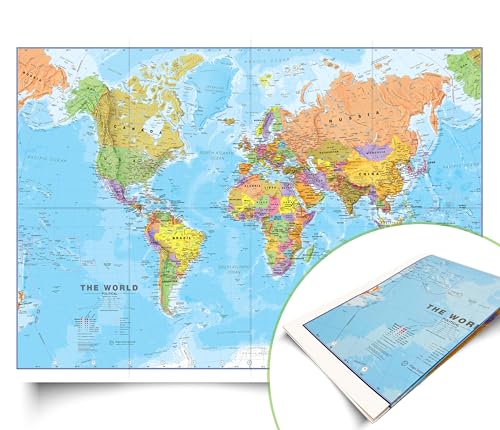
The Maps International World Map on silk art paper combines a refined finish with practical folded delivery. Sized 23″ x 33″, it carries a 1:40m scale that supports detailed study while staying manageable for wall display. The foldable format makes it easy to transport or store when not in use, and the silk art paper provides an elegant look suitable for executive offices or modern classrooms. The 2025 update ensures current political boundaries and country colors are accurate for learners and planners alike.
Buying Guide: Key Considerations For Choosing A Close-Up World Map
- Size and readability: Large formats provide detail from a distance, while smaller formats fit compact spaces. Consider the room size and the expected viewing distance.
- Durability: Laminated maps resist wear and allow dry-erase writing in teaching settings. Non-laminated posters may suit temporary displays but require careful handling.
- Format flexibility: Laminated sheets, posters, and foldable formats each suit different usage patterns—permanent wall mounting, portable classrooms, or travel planning.
- Detail and accuracy: Look for up-to-date political boundaries, physical features, and territorial shading. Recognize that some maps prioritize political detail, others physical relief, and some offer both.
- Interactivity: Scratch-off maps and whiteboard-friendly surfaces enable engagement, planning, and record-keeping of travel ideas or learning milestones.
- Brand and update frequency: Reputable brands often maintain updated editions to reflect geopolitical changes. Check for recent release notes or edition year.
- Visual design: Color schemes, lettering clarity, and shading styles affect legibility and classroom aesthetics. Select a style that complements your decor and lighting.
- Ease of installation and storage: Folded formats and rolled laminates offer straightforward setup, while large laminated sheets require wall-space planning and proper mounting.
- Budget and durability balance: Decide between premium laminated options for long-term use and more economical posters for temporary displays or learning events.
These considerations help ensure the chosen map not only looks appealing but also serves as a practical teaching and planning tool, suitable for varied environments—from classrooms to home study corners to busy offices.